THANK YOU FOR ATTENDING OUR SURVEY EQUIPMENT SHOWCASE EVENT
LEARN MORE ABOUT THE INNOVATION OF CHCNAV EQUIPMENT BELOW

Automated data capture of the underwater world like never before
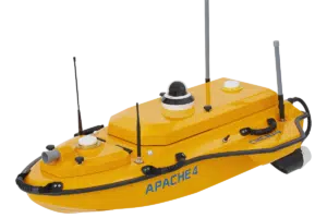
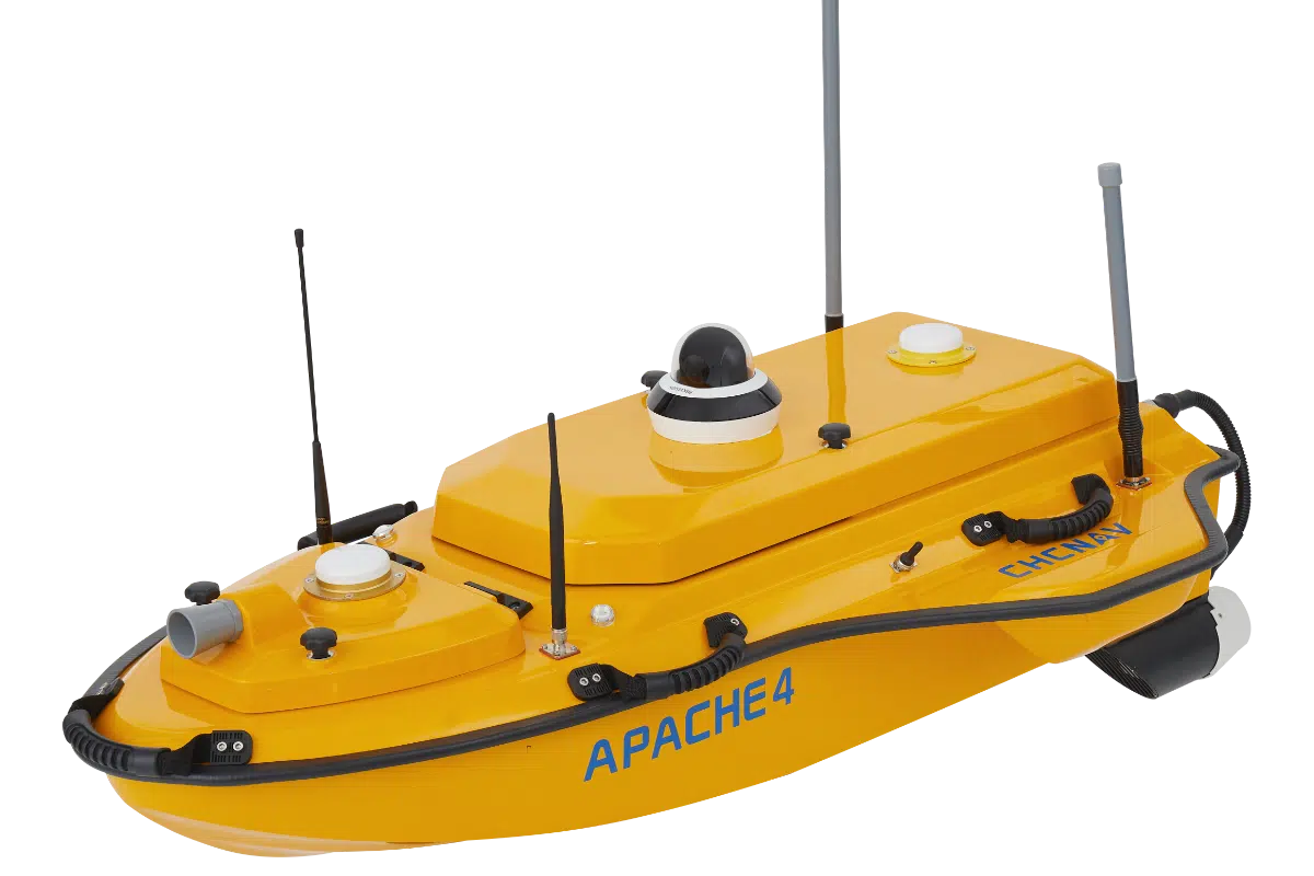
The apache 4 MARINE SYSTEM
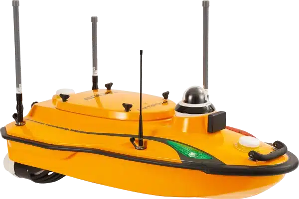
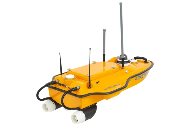
The Apache 4 is a compact yet highly capable Unmanned Surface Vessel l designed by CHC Navigation to deliver precise, reliable results, no matter how challenging the environment.
Purpose-built for areas that are difficult or hazardous for human access, the Apache 4 offers a highly portable solution without compromising performance. This means you can collect high-quality hydrographic data like never before.
It stays on course and captures precise data, even in tough conditions. With dual GNSS and IMU integration, you get reliable positioning when GPS signals drop off. Autonomous navigation takes the pressure off, letting you safely survey hard-to-reach areas without setting foot in the water. Paired with single or multibeam echo sounders, it delivers high-resolution depth profiles from just 15 cm to 200 m deep, with pinpoint ±0.01 m accuracy.
Features
Thanks to a GNSS + IMU positioning system, the Apache 4 stays on course even in turbulent flow or when GPS signals are limited. This means highly accurate cross-sectional data, especially important for flood modelling and riverbed profiling.
At the start and end of ADCP observations, the vessel can hover steadily in place, reducing noise in flow estimations and increasing data reliability.
With depth range capabilities from 0.15 to 200 meters and ±0.01 m accuracy, this unit provides detailed water depth profiles and can verify or complement ADCP tracking data.
Don’t let its size fool you: this vessel can carry up to 35 kg of payload, including ADCP sensors, multi-beam echo sounders, side scan sonar, and water quality monitors.
With up to 8 hours of endurance on a single charge and hot swappable batteries, teams can complete large surveys in one go -no mid-mission swaps or delays.
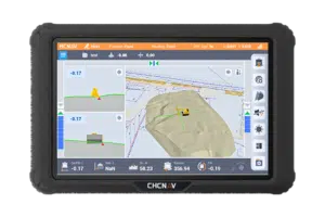
Using CHC’s dedicated Easysail app and Android control system, operators can plan missions, view live video of the area with built-in 360 camera, data feeds, and make real-time adjustments -all from shore.
With millimeter-wave obstacle detection, auto-return on low battery or lost signal, and a triple-hull carbon fiber design (IP67 rated), safety and reliability are built into every survey.
Physical Properties
Performances
- Speed max: 6 m/s
- Payload capacity: Up to 35 kg
- Draft: 12 cm
- Positioning: Full GNSS + IMU
Echosounder
- Type: Single beam, 200 kHz
- Range: 0.15 to 200 m
- Resolution: ±0.01 m + 0.1% x D
ADCP
- Type: CHCNAV RS600/1200
- Transducer: 5 beams
- Accuracy: ±0.25% ±2 mm/s
Sensors
- Camera: 360° video
Main Features
- GNSS RTK + INS: Positioning even with interrupted GNSS signals.
- Power Management: Smart balanced power supply.
- CHCNAV D270 Echosounder: Accurate depth measurements.
- Android OS: Integrated data acquisition, post-processing, and real-time parameter display.
Marine Systems

Revolutionising the way 3d point clouds are captured effectively
The Apache 4 is a compact yet highly capable Unmanned Surface Vessel l designed by CHC Navigation to deliver precise, reliable results, no matter how challenging the environment.
Rs10 Laser Scanner
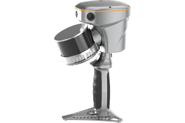
The RS10 brings a new approach to geospatial surveying by integrating GNSS RTK, laser scanning, and visual SLAM technologies into a single, powerful platform.
Its speed, user-friendly design, high level of detail and exceptional accuracy aren’t just impressive features for surveying equipment; they’re helping to redefine standards across the entire surveying industry.
This comes in two models: the 300m version and the regular version. Designed to improve the efficiency and accuracy of indoor and outdoor 3D scanning and surveying tasks. The RS10 is a versatile solution for surveying, civil engineering, and BIM professionals, as well as for applications such as agricultural and forestry surveying, power line inspection, material pile volume calculation, and data collection in underground spaces.
Videos
CHCNAV | RS10 - Data Process Part 5 (GCP Adjustment)
CHCNAV | RS10 - Data Process Part 4 (Quality Check)
CHCNAV | RS10 - Data Process Part 3 (Accuracy Optimization TGCP)
CHCNAV | RS10 - Data Process Part 2 (Accuracy Optimization)
CHCNAV | RS10 - Data Process Part 1 (Create Project)
CHCNAV | RS10 - Unboxing, Initialization setup and Quick Start
Features
Combines satellite positioning and visual mapping for seamless indoor and outdoor surveying, achieving up to 5cm absolute accuracy even in GNSS-limited areas.
Utilises LiDAR technology to deliver centimetre-level accuracy for detailed 3D point clouds.
Provides instant georeferenced 3D models in the field, reducing post-processing time and improving workflow efficiency.
The portable and robust construction makes these devices easy to carry and reliable in challenging conditions.
Compatible with industry-standard software, enabling seamless data transfer for further analysis and modelling
Physical Properties
Equipped with a powerful on-board processor, the RS10 provides real-time SLAM (Simultaneous Localization and Mapping) capabilities to create georeferenced point clouds directly in the field without the need for post-processing. With immediate feedback on the collected data, users can make adjustments on the fly to ensure complete and detailed scan coverage. The RS10 can map large areas up to 13,000 square meters in real-time, making it ideal for rapid or complex surveying projects where time and accuracy are critical.
laser scanners

Bringing gnss rover performance & expectations to another lvel
GNSS SENSORS & SURVEYING ROVERS
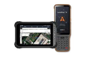
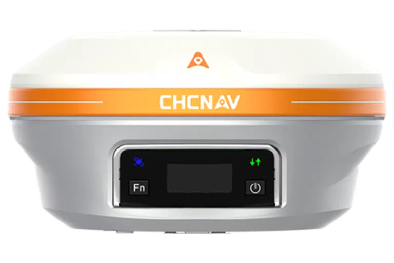
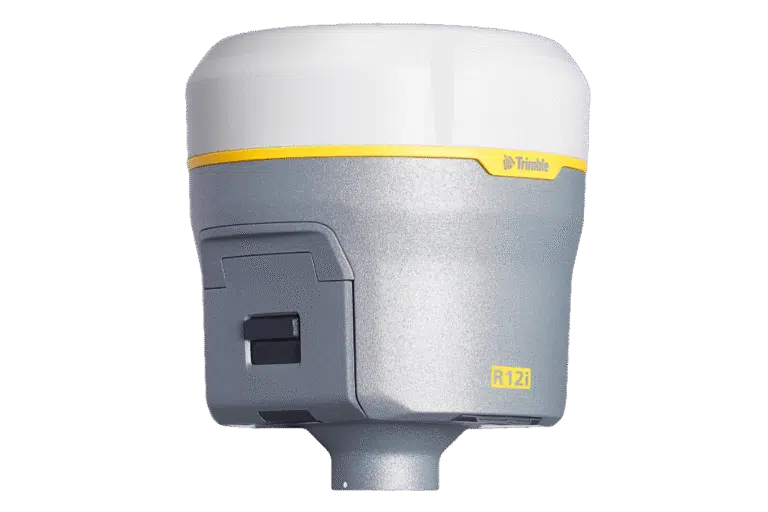
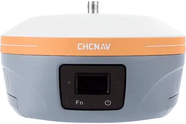
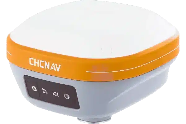
CHCNAV is redefining GNSS positioning with systems built for surveyors, engineers, and construction professionals who demand accuracy and reliability. By combining multi-constellation satellite tracking, intelligent tilt compensation, and rugged, field-ready design, our GNSS sensors deliver fast, precise results. Using signals from multiple satellites, the sensors calculate their exact location through triangulation, analyzing the time delay from at least four satellites. To push accuracy even further, they leverage Real-Time Kinematic (RTK) correction data from a base station, reducing atmospheric errors and achieving centimetre-level precision.
The result is highly accurate latitude, longitude, and altitude coordinates that integrate seamlessly with mapping software and field tools. Whether for surveying, construction, or navigation, CHCNAV’s GNSS solutions simplify complex tasks and deliver dependable performance, even in the most demanding environments.
Videos
CHCNAV | i93 - Precision and Efficiency Surveying with Auto-IMU and iStar algorithm
CHCNAV | i89 - Kit Unboxing, Initialization setup and Quick Start
CHCNAV | i93 Visual IMU-RTK Stream Live - English
Introducing the i73 IMU-RTK GNSS Receiver Key Features | CHCNAV
Features
Our devices track signals from multiple satellite constellations. This multi-constellation support ensures robust and reliable positioning, even in challenging environments like dense urban areas or under-tree canopies.
This enables accurate measurements even when the survey pole isn’t perfectly upright. This feature improves efficiency and allows for faster data collection without compromising accuracy.
With built-in UHF or network connectivity, GNSS sensors can function as either a base station or a rover. This flexibility allows them to adapt to different surveying setups, whether establishing a local reference or gathering data in the field.
Designed with fieldwork in mind, our GNSS sensors are compact and easy to transport
Built to withstand the toughest conditions, our GNSS sensors are rated for dust, water, and shock resistance. This rugged design ensures reliable performance in harsh weather and on demanding job sites.
Physical Properties
Equipped with a powerful on-board processor, the RS10 provides real-time SLAM (Simultaneous Localization and Mapping) capabilities to create georeferenced point clouds directly in the field without the need for post-processing. With immediate feedback on the collected data, users can make adjustments on the fly to ensure complete and detailed scan coverage. The RS10 can map large areas up to 13,000 square meters in real-time, making it ideal for rapid or complex surveying projects where time and accuracy are critical.
GNSS SENSORS & SURVEYING ROVERS

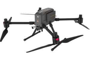
Unparalled flight times & unmatched performance with modular payloads
X500 DRONE UAV SYSTEM
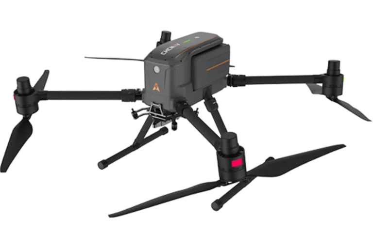
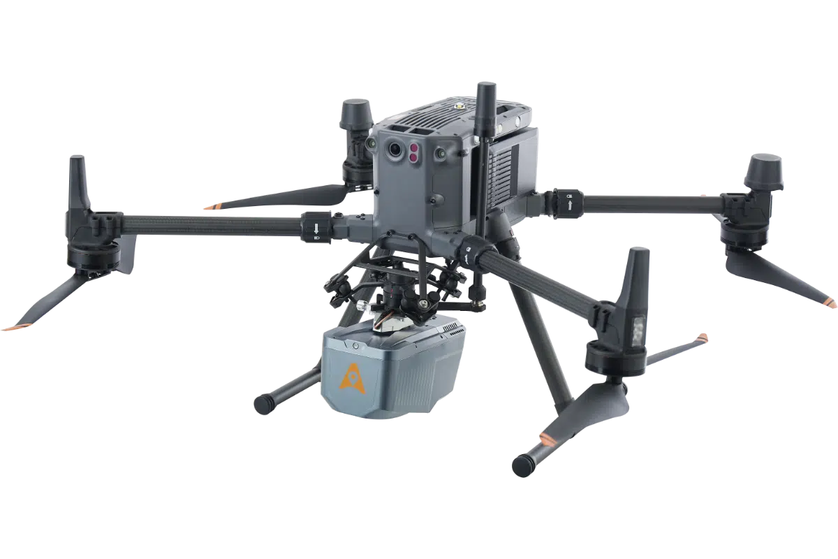
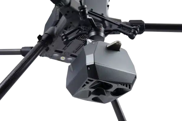
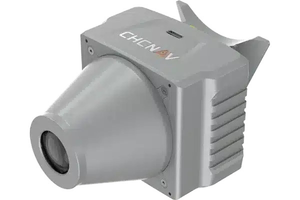
The CHCNAV X500 is a next-generation UAV newly available in the UK, and already redefining expectations for professional drone operations. With industry-leading endurance, a 5kg payload capacity and centimetre-level positioning accuracy, it brings together power, precision and flexibility into one platform.
The X500 supports a 5 kg payload capacity and offers a flight endurance of 58 minutes, or up to 50 minutes when equipped with the CHCNAV AA10 LiDAR. Its IP55 rating and 12 m/s wind resistance enable reliable performance in challenging environments.
This is a game changer for the drone surveying world, allowing you to streamline workflows, improve data quality and cover more ground with fewer flights.
Videos
Features
This combination ensures precise positioning and orientation, which is essential for accurate mapping and data collection, even in challenging environments.
Our devices can carry a range of sensors, from LiDAR systems to cameras, enabling versatile applications from surveying to environmental monitoring.
With long flight durations, UAV systems can cover large areas in a single mission, improving operational efficiency and reducing the need for frequent recharges.
Equipped with advanced GNSS and IMU technology, our UAV systems provide precise data that is ideal for creating detailed 3D models and maps.
The drone can follow pre-programmed routes while ensuring flight safety.
Performances
- Payload capacity : 5 kg max.
- Flight time : 50 mins with CHCNAV AA10
Physical
- Type : Quadcopter
- Battery life : Double hot-swap, with charging station
Sensors
- Camera : Yes
- IMU : Yes
- Obstacle avoidance : Yes
- vSLAM : Yes
Connectivity
- Remote : CHCNAV SmartGo flight control software
Main features
- Reliable Design – Adjusts altitude to avoid crashes. Landing even if a propeller malfunctions.
- Hot-Swap Batteries – Seamless takeoffs and continuous power for multiple flights.
- Intelligent Battery Station – Functions as a power bank for greater efficiency in the field.
- Lightweight and Portable – Single-person operation and easy transport.
UAV Systems
Why Work With Us
High Quality
Equipment
We sell only sell surveying equipment that is built for accuracy, durability and performance in all conditions.
Approved by real surveyors
Every product is rigorously tested by our team of experienced professionals to ensure it meets the demands of real-world surveying.
ongoing advice & support
Our expert team is always on hand to provide demonstrations, guidance, technical support, before and after purchase.























How to Match Multiple Scans From RS10